Seasonal Guides
Seasonal Patterns for U.S. Coastal Travel Planning
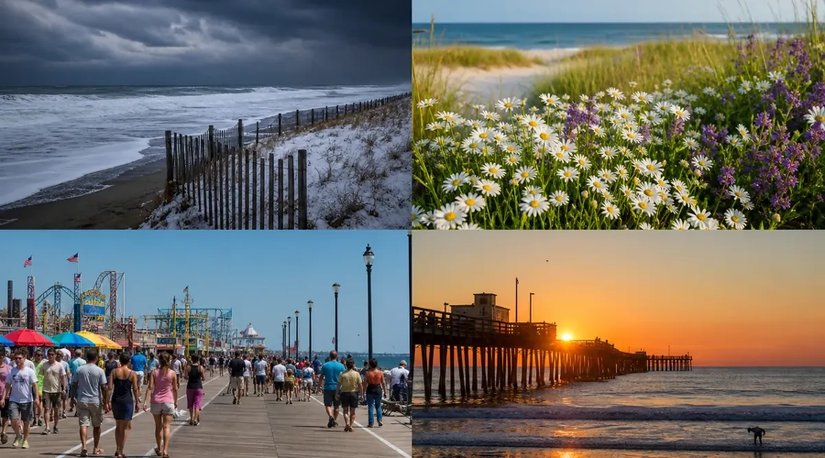
United States coastal environments change dramatically across seasons in ways that affect weather comfort, wildlife visibility, water temperature, facility hours, lodging availability, and hazard profiles. Educational seasonal planning compares meteorological averages, ecological calendars, and institutional schedules rather than relying on generic best time to visit lists that ignore regional specificity. A Gulf Coast winter may suit birders observing migratory species while the same month brings snow closures to Lake Superior shorelines; synchronizing trip timing with personal priorities prevents mismatched expectations.
Climate change introduces additional variability into historical seasonal norms documented in NOAA climate summaries; cherry-picked past decade anecdotes may mislead planners about current storm frequency, heat index trends, and bloom timing shifts affecting coastal visits. Educational travelers consult recent five-year averages and official seasonal outlook products while maintaining flexibility for anomaly years producing early hurricanes, prolonged marine heatwaves, or delayed spring thaw affecting access roads to northern trailheads.
This guide presents general educational information about seasonal coastal travel patterns in the United States. It does not constitute personalized travel advice, booking recommendations, or guarantees about weather, wildlife presence, or facility operations. Schedules and conditions change annually. Verify current seasonal programs, closures, and advisories through official park calendars, state tourism seasonal pages, and National Weather Service climate outlooks before finalizing plans.
Spring Coastal Conditions and Opportunities
Spring along Atlantic and Gulf coasts brings warming air temperatures from March through May with water lagging air by several weeks; swimming comfort remains limited for many visitors until late May or June despite sunny beach weather. Shorebird migration peaks in April and May along Delaware Bay horseshoe crab spawning beaches and Gulf Coast refuges, offering world-class birding without summer insect intensity. National seashore facilities reopen gradually after winter maintenance; some campgrounds activate reservation windows in spring for summer peak documented on recreation.gov release schedules.
Pacific Northwest spring combines wildflower displays on coastal bluffs with persistent rain showers requiring waterproof layering systems. California spring marine mammal activity includes gray whale northbound migration viewable into May from shore platforms. Spring break weeks concentrate family travel in Florida and Texas producing lodging price spikes distinct from ecological seasonality; educational planners distinguish school calendar demand from natural seasonal optimal framing.
- Monitor pollen forecasts if coastal marsh spring blooms trigger respiratory allergies during outdoor activities.
- Review sea turtle nesting season start dates before planning nighttime beach walks with bright flashlights in southern states.
- Check whether spring storm systems nor'easters produce coastal flooding on mid-Atlantic visits in March and April.
Summer Peak Season Dynamics
Summer represents peak visitation for most accessible U.S. beaches with lifeguard seasons, full interpretive programming, and maximum lodging rates June through August in northern latitudes extending into September for southern coasts. Heat index values along Gulf and Southeast Atlantic coasts routinely exceed comfort thresholds midday; scheduling active hikes for morning and beach relaxation under shade structures reduces heat illness risk. Hurricane season officially spans June 1 through November 30 Atlantic basin with peak activity August through October requiring itinerary monitoring via National Hurricane Center products even when landfall probability seems remote weeks ahead.
Alaska coastal cruise and wildlife season peaks June through August when daylight extends late and calmer seas statistically favor boat excursions though exceptions occur. Great Lakes beaches fill with regional drive tourists on holiday weekends; parking reservation systems activate at popular units including Indiana Dunes and Sleeping Bear. Wildfire smoke from interior western fires occasionally degrades Pacific coastal air quality during summer inversions trapping particulates against ocean layers.
- Purchase travel insurance understanding hurricane-related cancellation clauses before peak season bookings.
- Reserve timed-entry passes for high-demand national seashore units when summer systems require them.
- Hydrate aggressively during humid Southeast beach days regardless of perceived exertion level.
Autumn Shoulder Season Benefits and Tradeoffs
Autumn shoulder seasons—September through November on Atlantic and Gulf coasts, later in southern California—offer reduced lodging rates, thinner crowds, and continued warm air with cooling water inviting waders but not all swimmers. Atlantic hurricane risk remains elevated through October; educational travelers monitor forecasts without assuming late-season immunity. Fall foliage appears in coastal Maine, Massachusetts, and Pacific Northwest maples intermixed with evergreen canopies creating distinctive photographic opportunities combining ocean and autumn color uncommon in interior leaf-peeping destinations.
Pacific storm season begins intensifying surf and pier closure frequencies Oregon northward; beach log hazards increase after first major storms deposit fresh driftwood. Monarch butterfly migration along California central coast peaks mid-October at sanctuary sites with docent programs explaining population decline research. Restaurant and shop hours shorten in tourist towns after Labor Day; verifying business schedules prevents arriving in communities where only grocery and fuel remain consistently open.
- Pack layers for thirty-degree daily temperature swings common in autumn New England coastal towns.
- Verify campground closure dates; many northern coastal parks shut water systems before first hard freeze.
- Observe hunting seasons in adjacent coastal wildlife management areas where hiking near marsh edges may require blaze orange attire during designated weeks.
Winter Coastal Visitation and Specialized Interests
Winter transforms northern coastlines with snow on dunes, ice formations on Great Lakes shores, and minimal commercial tourism infrastructure in towns closing seasonal businesses November through April. Winter birding along mid-Atlantic and Gulf coasts attracts species avoiding northern latitudes; Christmas Bird Count circles welcome participant observers with registration through National Audubon Society local chapters. Florida, southern Texas, and Hawaii winter seasons represent peak snowbird visitation with traffic congestion distinct from summer family patterns.
Storm watching on Pacific Northwest beaches draws experienced observers studying wave energy during king tides and atmospheric river events; inexperienced visitors should remain on designated overlooks rather than exposed jetties where sneaker waves intensify during winter swell. New England nor'easters may close coastal roads temporarily; state DOT road condition maps provide authoritative closure status. Polar vortex episodes rarely reach Gulf beaches but can freeze coastal Texas wetlands briefly, creating unusual photographic conditions with corresponding infrastructure strain on uninsulated lodging plumbing.
- Confirm ferry winter schedules reduced frequency may strand travelers missing last daily departure.
- Carry traction aids for icy boardwalk segments in northern coastal parks open year-round.
- Review manatee aggregation season in Florida springs December through March when in-water observation rules apply separately from open ocean seasons.
Regional Synthesis and Decision Frameworks
Choosing seasonal timing involves prioritizing ranked variables: water temperature minimum acceptable for swimming, tolerance for crowds, budget sensitivity to peak rates, wildlife target species presence windows, and acceptable hurricane or wildfire smoke risk exposure. No month optimizes all variables simultaneously; explicit tradeoff acknowledgment improves satisfaction more than searching mythical perfect weeks marketed in affiliate travel content without ecological basis.
Educational seasonal guides integrate lunar tidal extremes affecting beach width, commercial fishing season openings influencing restaurant species menus, and academic calendar constraints on families unable to travel outside school breaks regardless of ecological optimal timing. Recognizing structural constraints on personal schedules reframes trips toward maximizing learning within available windows rather than lamenting unavoidable suboptimal timing.
Year-Round Destinations Versus Highly Seasonal Coasts
Southern California, Hawaii, and South Florida coasts support year-round outdoor activity with seasonal variation more in rainfall and swell than temperature extremes prohibiting visitation. Maine, Alaska, and Lake Superior shores exhibit sharp seasonality where identical locations feel like different destinations across months. Highly seasonal coasts reward repeat visitation across seasons by same travelers observing ecological turnover impossible in single week snapshot visits.
Shoulder season travel supports local economies during cash-flow thin periods when seasonal workers struggle between peaks; educational travelers choosing September beach weeks or April birding trips contribute to distributed tourism revenue without claiming moral superiority over peak-season visitors whose schedules permit only summer travel.
- Download NOAA climate normals for nearest coastal weather station when comparing candidate travel months statistically.
- Subscribe to park-specific email newsletters announcing seasonal program releases and prescribed burn smoke advisories.
- Align lighthouse tower climb seasons with regional opening calendars often limited to Memorial Day through Columbus Day windows.
- Track El Niño Southern Oscillation outlook summaries influencing Pacific storm track probabilities affecting winter California coastal planning.
Building Flexible Seasonal Itineraries
Flexible itineraries incorporate indoor marine science backups for outdoor-dependent plans, refundable lodging when policies permit, and multi-night stays reducing pressure to force activities during single-day weather failures. Educational seasonal travel logs comparing forecast versus observed conditions across years build personal calibration improving future planning accuracy more than any static seasonal ranking article can provide for diverse personal priorities.
Climate adaptation investments visible in coastal communities—elevated boardwalks, cooling shade structures, expanded indoor interpretive space—signal how destinations respond to lengthening heat seasons and intensifying storms. Observing these changes during visits connects tourism experience to broader coastal resilience education discussed in public planning documents available on municipal websites alongside tourism marketing materials emphasizing only favorable seasonal imagery.
- Maintain printed backup schedules when digital apps fail during storm-related power outages affecting coastal towns.
- Compare historical and current NOAA tidal epoch data when planning intertidal activities across decades-spanning return visits.
- Respect seasonal wildlife closures even when weather feels inviting; nesting and pupping seasons override recreational convenience.
- Document seasonal observations contributing to community science phenology projects extending educational impact beyond trip duration.